Torrential Rains Douse South Metro
July 7 - 10, 2000
 Torrential rains
fell upon the Twin Cities metropolitan area during the weekend of July 7 - 10. Torrential rains
fell upon the Twin Cities metropolitan area during the weekend of July 7 - 10.
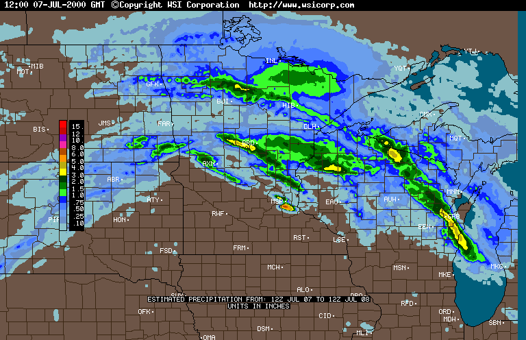
The spate of severe weather began during the morning of Friday, July 7
when severe storms rumbled through the east metro. High winds, hail, and possible
tornadoes led to significant property damage.
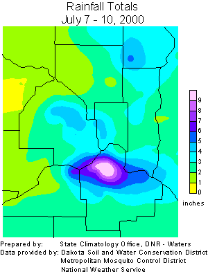
The south metro, specifically the city of Eagan, received an extraordinary
amount of precipitation later on the 7th, and during the early morning hours of Saturday,
July 8. Over eight inches of rain fell in a three to five hour span across a small area of
northern Dakota county. The climatological probability of receiving eight inches of rain
in a five hour period for a given location in the metropolitan area, in a given year, is
far less than 1%.
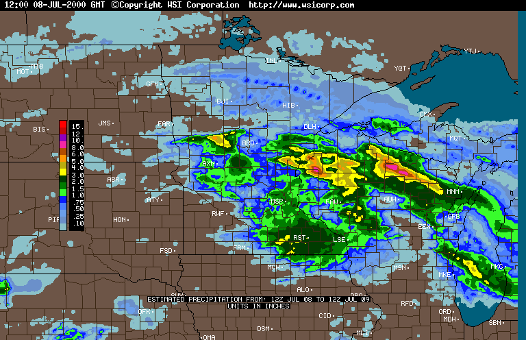
An additional two to three inches of rain drenched already sodden
neighborhoods during the evening of July 8 and the early morning of Sunday, July 9. Light
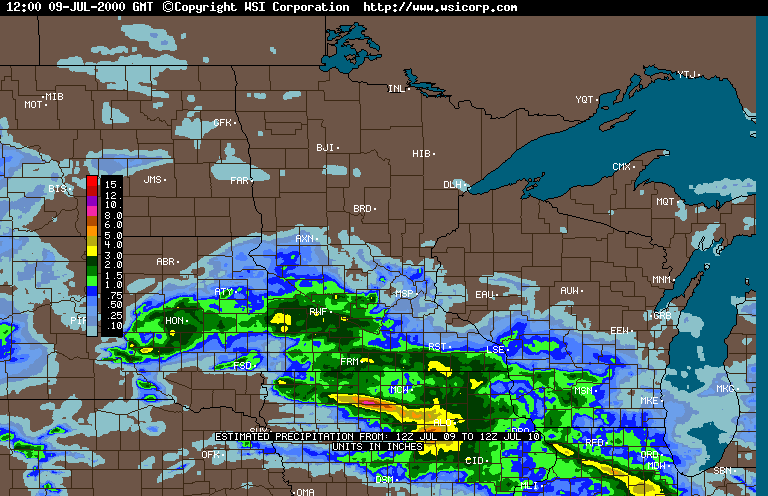
rainfall fell again late in the late evening of July 9 and the early morning hours of
Monday, July 10. The highest reported weekend rainfall total was 11.33 inches in
southeastern Eagan.
The heavy rains led to extensive damage in some south metro communities.
Serious urban flooding was commonplace, and severe erosion was reported in many areas. One
life was lost in a flood-related incident.
WSI radar-based
precipitation estimate - July 8
WSI radar-based precipitation estimate -
July 9
WSI radar-based precipitation estimate -
July 10
Numerous requests have been made of the State Climatology
Office for precipitation data describing this period. To aid investigators,
we have compiled a table of all daily precipitation data archived by this
office for Dakota County in July 2000.
(revised 1/9/01)

 Return to the Climate Journal Return to the Climate Journal
mcwg@soils.umn.edu
URL: http://climate.umn.edu/doc/journal/flash_floods/ff000710.htm
Last modified: January 9, 2001
|